Datei:Liverpool Bay.png

Größe dieser Vorschau: 800 × 593 Pixel. Weitere Auflösungen: 320 × 237 Pixel | 640 × 474 Pixel | 1.024 × 759 Pixel | 1.278 × 947 Pixel.
Originaldatei (1.278 × 947 Pixel, Dateigröße: 1,84 MB, MIME-Typ: image/png)
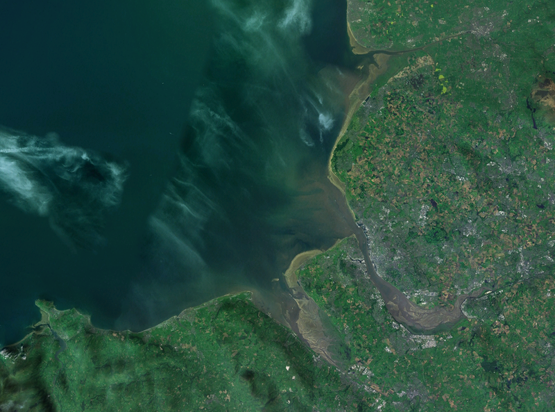
| Beschreibung | A satellite photograph of Liverpool Bay, showing the West Lancashire Coastal Plain River Ribble at the top (north), the River Alt (hardly visble), River Mersey (centre) River Dee and the River Conwy in the south west. |
| Datum | |
| Quelle | NASA World Wind - Landsat 7 |
| Urheber | Smurrayinchester |
| Diese Datei ist gemeinfrei (Public Domain), da es sich um einen Screenshot der NASA-Software World Wind handelt, in der ein gemeinfreier Datensatz wie Blue Marble, MODIS, Landsat, SRTM, USGS oder GLOBE verwendet wird.
|
 |
| Kameraposition | | Dieses und weitere Bilder auf OpenStreetMap |
|---|

Dateiversionen
Klicke auf einen Zeitpunkt, um diese Version zu laden.
| Version vom | Vorschaubild | Maße | Benutzer | Kommentar | |
|---|---|---|---|---|---|
| aktuell | 16:06, 28. Apr. 2007 | | 1.278 × 947 (1,84 MB) | wikimediacommons>Smurrayinchester | {{Information |Description=A satellite photograph of w:Liverpool Bay, showing the Rivers Dee and Mersey (centre), the River Alt (north) and the River Conwy (west). |Source=NASA World Wind - Landsat 7 |Date=28 April 2007 |Author= [[User:Smurrayincheste |
Dateiverwendung
Die folgende Seite verwendet diese Datei: