Datei:Subsurface erosion of soil into karst conduit by water level fluctuation.jpg
Größe dieser Vorschau: 446 × 600 Pixel. Weitere Auflösungen: 178 × 240 Pixel | 357 × 480 Pixel | 571 × 768 Pixel | 761 × 1.024 Pixel | 2.231 × 3.000 Pixel.
Originaldatei (2.231 × 3.000 Pixel, Dateigröße: 2,83 MB, MIME-Typ: image/jpeg)
Beschreibung
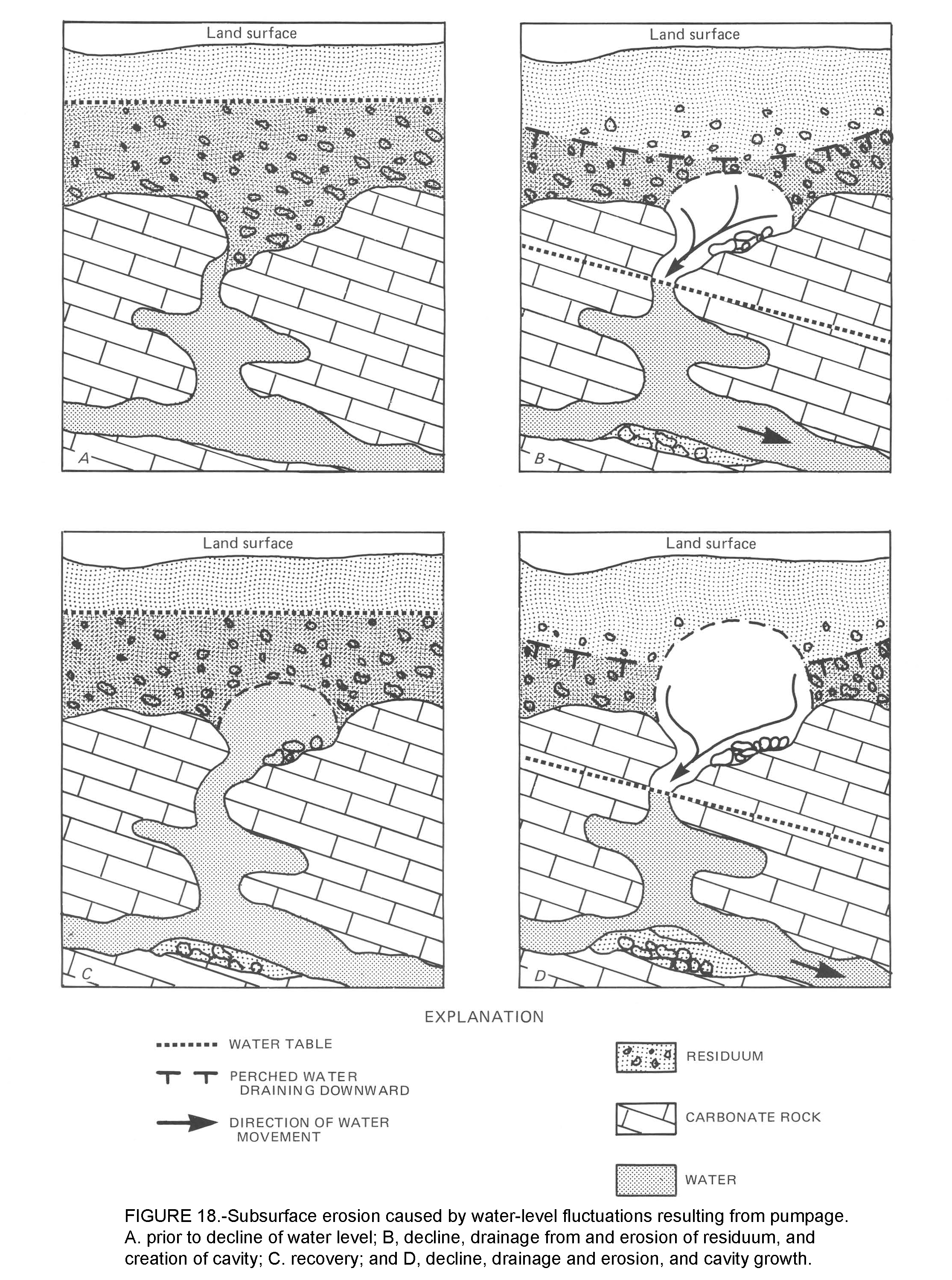
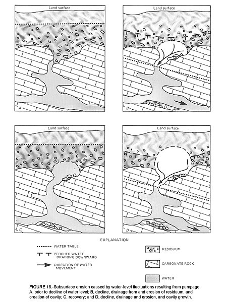
Illustration of "erosion from below" shows how the fluctuation of the water table above and below the soil-rock contact develops cover collapse sinkholes. This is Figure 18 on pages 22 and 23 of Newton, John G., "Development of sinkholes resulting from man's activities in the eastern United States", US Geological Survey, 1987, CIRCULAR 968. Available at https://pubs.usgs.gov/circ/1987/0968/report.pdf
Lizenz
Dieses Bild ist gemeinfrei (public domain), weil es Materialien beeinhaltet, die ursprünglich vom United States Geological Survey, einer Behörde des Innenministeriums der Vereinigten Staaten, stammen. Weitere Informationen finden Sie in den Urheberrechtsbestimmungen des USGS
|
Dateiversionen
Klicke auf einen Zeitpunkt, um diese Version zu laden.
| Version vom | Vorschaubild | Maße | Benutzer | Kommentar | |
|---|---|---|---|---|---|
| aktuell | 00:45, 4. Mai 2019 | | 2.231 × 3.000 (2,83 MB) | wikimediacommons>RockDoc485 | Illustrates how the fluctuation of the water table above and below the soil/rock surface develops sinkholes. Figure 18 of Newton, John G. "Development of sinkholes resulting from man's activities in the eastern United States". US Geological Survey, 1987, CIRCULAR 968 on pages 22 and 23. Available at https://pubs.usgs.gov/circ/1987/0968/report.pdf |
Dateiverwendung
Die folgende Seite verwendet diese Datei: